NSF CRII: OAC: Real-time Computational Modeling of Crop Phenological Progress towards Scalable Satellite Precision Farming
Precision agriculture aims to leverage advanced data-intensive technology to maximize agricultural productivity and to reduce environmental footprints. With considerable technological advancements, it is a pivotal time to harness the intensive data collected in space and time to benchmark precision agriculture systems worldwide. The recent launch of groups of satellites designed to work together -- known as "satellite constellations" -- opens up unprecedented opportunities to revolutionize precision agriculture, through monitoring the crop phenological progress at fine spatial and temporal scales. However, the gigantic amount of data brings significant challenges to conventional remote sensing software and tools. The overarching goal of this project is to prototype advanced remote sensing cyberinfrastructure in support of both data- and compute-intensive satellite-based precision agriculture systems. This advanced cyberinfrastructure is applicable to a diverse range of agricultural systems, especially for resource poor and vulnerable smallholder farming systems. With its potential to improve global farming practices, the cyberinfrastructure helps optimize the trajectory of agricultural development to meet future crop demands as well as lower environmental impacts. The integrated educational and training activities of the project offer unique learning opportunities to students of various academic levels and backgrounds, and enhance the broader engagement of diverse scientific communities, especially minority and underrepresented groups. Therefore, this research aligns with the NSF mission to promote the progress of science and to advance the national health, prosperity and welfare.
The advanced remote sensing cyberinfrastructure focuses on the development of an innovative real-time phenological computational (RTPC) model and a high-performance system to harness massive parallelism in modeling crop phenological progress towards scalable satellite-based precision farming. 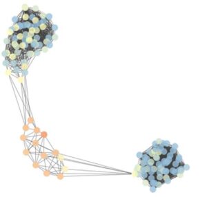 The RTPC model integrates dynamic complex networks with time series remote sensing, and is unique to predict the real-time crop phenological progress at both fine spatial and temporal scales. The high-performance system enhances the parallelism of the RTPC using a hybrid computation model, including a node-level computation model and a system-wide data distribution model. The node-level computation model takes advantage of multi-core architecture of computing nodes to parallelize the compute-intensive RTPC in predicting dynamic network characteristics of crop phenology. The system-wide data distribution model devises a novel Space-and-Time parallel decomposition strategy in distributing massive remote sensing time series data to reduce memory requirements and to achieve high scalability. An open-source toolkit is designed to facilitate the open development and adoption of the remote sensing cyberinfrastructure across a broad range of disciplines. Through leveraging the power of high performance computing and this hybrid computation model, the cyberinfrastructure can analyze massive remotely sensed data in a highly scalable manner to conduct real-time monitoring of earth system dynamics.